31 March 2009

Chino Hills Champion Carbon Canyon Chronicling

It's probably been said here before, but residents of Chino and Chino Hills need to support the Champion newspaper. It is an excellent local paper with good local stories and a fine editorial page, as well as an impressive history. The Champion has been continuously published weekly since 1887, making it the oldest newspaper in the region and one of the longest-lasting in California. In this age of the rapidly-deteriorating press, it should be a local priority to keep the Champion alive and well. Not just because of its historical significance, but because the paper is relevant. Speaking of which, last Saturday's edition had several relevant articles for Carbon Canyon.

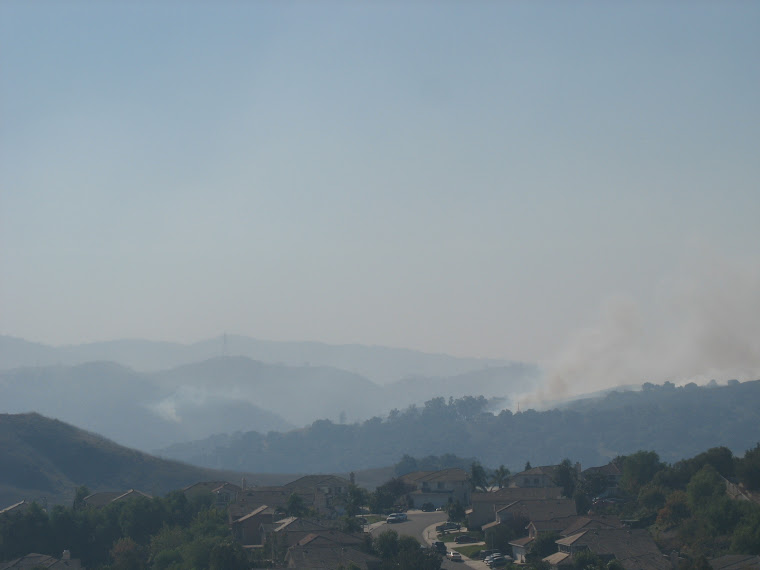
First up, the Carbon Canyon Fire Safe Council is moving its meetings at the Sleepy Hollow Community Center from the first Tuesday to the first Wednesday of each month. The reason? Folks from Olinda Village over in Brea have joined the council, rather than form their own, which is a great thing for the council, for Olinda Village, and for stronger connections between the Chino Hills and Brea portions of the Canyon. When it comes to the Canyon, in fact, the geographical distinctions between cities (and counties) seems more artificial than it might appear elsewhere. Certainly a fire is not going to recognize the boundaries! Tomorrow night, the 1st, at 7 p.m. is the first meeting under the new schedule and there will be discussion on networking with surrounding communities (such as La Habra Heights, perhaps, which was just featured on a post on the blog?); obtaining money for fighting highly-invasive and flammable arundo; dealing with brush removal; fire danger signs for the Canyon; volunteers to patrol the Canyon during the threat of fire; and a "Wildfire Awareness Fair" for 30 May.

A related short article pointed out that Chino Valley's rainfall total, as the rainy season comes near its end, was only 5.23 inches, less than one-third the normal rainfall and only one-half of last year's subpar total. This is a surprising figure because, according to the Los Angeles Times, the rainfall total in Fullerton, only a few miles away, has been slightly above normal, while totals in Los Angeles and Ventura have been below. At any rate, reservoir storage in Californis remains at a low level and a water emergency has already been declared by the Governor. This does not bode well for water supply, nor for our upcoming fire season.

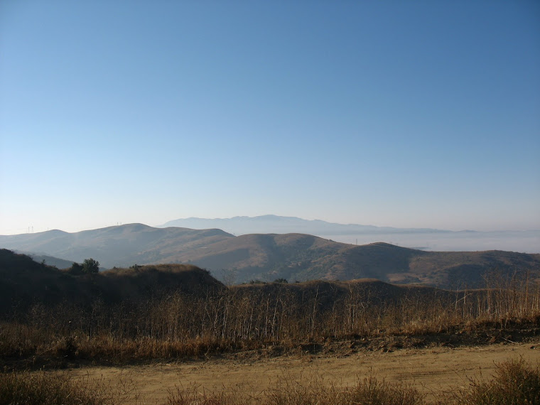
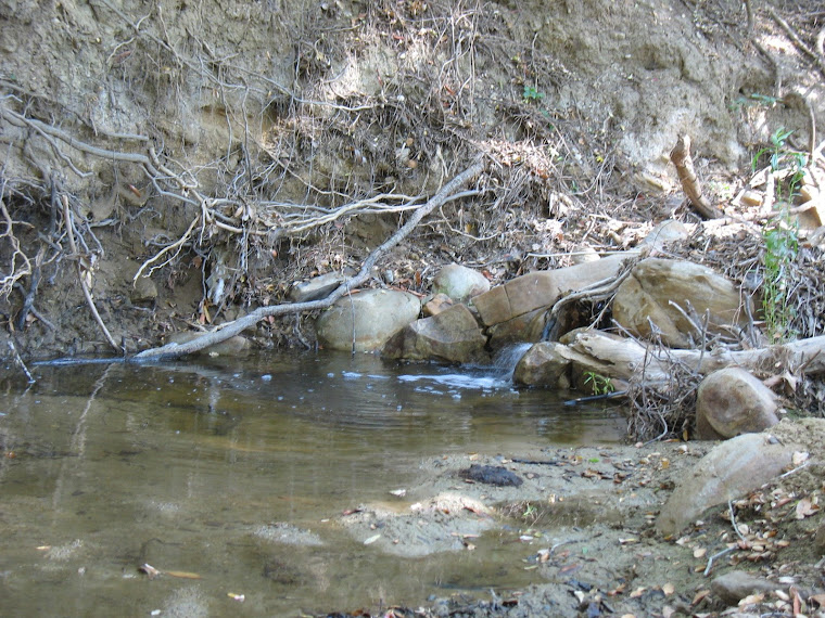
This, in turn, leads to the next article, which concerns the deceptive display of lush greenery in Chino Hills State Park (and, by extension, the areas, including Carbon Canyon, around it.) Deceptive, because invasive grasses and weeds are taking advantage of the clearing caused by last November's Freeway Complex Fire to invade the park and keep out native plants. Park personnel, already at low numbers for such a large, albeit passive-use, setting before the economic downturn, are doing their best to eradicate these destructive invasives, there is so much to combat. Fortunately, according to ecologist Alissa Ing, there is a strong recovery of plants and trees in many sections of the park, such as riparian habitats where chaparral, sage scrub, sycamores, and oaks are showing encouraging signs. Other state park news: $30,000 in repairs to bridges and clearing emergency roads has been conducted, though some trails are closed because of destroyed bridges. Burned trail identification signs are being replaced by ones now on order and there is a request to FEMA to replace some fencing and for reimbursement for a 106-acre burn area that was a rehabilitation project before the fall fire.

Meanwhile, on the editorial page, there is a short piece referring to the fact that the invasive grasses that are taking root in the state park constitute a "flashy fuel," meaning that they are very flammable materials that will dry rapidly by June and be a real danger for future fires, unless they can be rooted out, which is being pursued, as noted above.

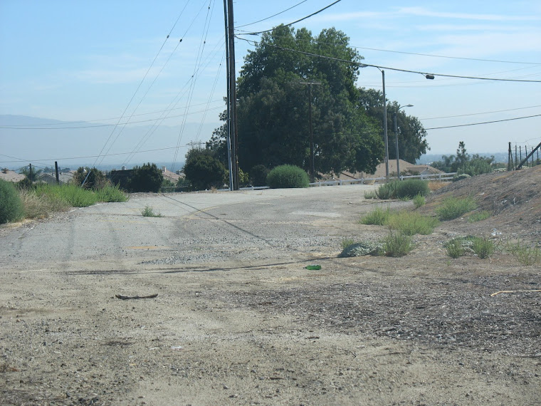
Further, there is one other short note in this same editorial section, concerning closures of Carbon Canyon Road. To quote directly, "To prevent Carbon Canyon residents from driving all the way to the Orange County line only to find Carbon Canyon Road closed during an incident, Chino Hills will request a reader board sign be placed at the fire station entrance on Carbon Canyon Road." Currently, there are signs placed at the eastern and western "mouths" of the Canyon, but for those of us who live in between, there has been no intermediate signage warning of closures. I'm all for placing a board at the Canon Lane intersection, so let's hope this happens.

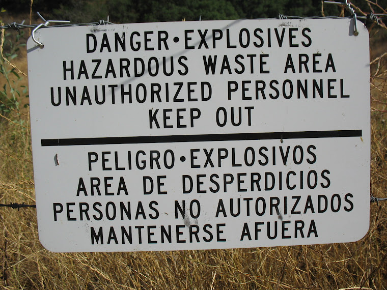
Finally, there is a recap of the Aerojet OB/OD (Open Burn/Open Detonation) certification by the state DTSC (Department of Toxic Substances Control.) Reporter Marianne Napoles wrote that "only a dozen residents showed up to the workshop," however, though it should be said that, given our incrementally-increasing apathy about most issues, this is hardly a surprise. As this matter has already been fairly extensively covered in this blog, there isn't much to add concerning the cleanup project, other than that this article concluded by stating that "Aerojet made an agreement with the city that it would not approach Chino Hills with a residential land use map until the DTSC makes a determination on the land use," by which I assume it is meant that, once DTSC certifies the land was properly cleaned and is safe, Aerojet will begin plans to build hundreds of homes on its property. That is a whole other future issue to ponder at a later date!

As a twelve-year subscriber to the paper, I can testify that it has been invaluable to my understanding of so many local issues and, once again, I'd like to encourage Chino and Chino Hills residents and others who are interested in the area to subscribe and support this local treasure! A link to the paper's web site is at the links section at the right edge of the main blog page.

30 March 2009

On the Skids in Carbon Canyon #s 1223 & 1224


In a post a few days back on an accident scene on Carbon Canyon Road (State Highway 142), there was mention of two other portions of the road where there were long skid marks of recent vintage, whether part of accidents or not.

What the above photographs very clearly show is that there were some people who were clearly driving way too fast and recklessly!

The lower images come from the intersection of Fairway Drive/Ginseng Lane on the Chino Hills side and the upper views are a little east of the burned-out Manely Friends Stable over in Brea. Both of these legacies are from within the last month or so.

It is interesting to see that the Chino Hills marks may have been made by two separate cars and it looks as if both were trying to pass people to the left by using the turn lanes to Fairway/Ginseng. In fact, it appears as if the car going westbound (lowest image) turned to the right at the tailend of the skid. Could both cars have been approaching each other at the same time or were these separate incidents? Note the very long skid mark on the image second from the bottom--that driver was really moving quickly!

The Brea marks might be more straightforward, if hardly straight! One shows the mark coming in from the east toward the edge of the road where I was standing, while the other shows the skid heading back, after a bounce off the low curb on the edge, into the roadway and crossing the centerline. Of course, it is possible these were made by two separate vehicles, but they are in almost direct proximity to one another.

Naturally, there are traffic officers in the Chino Hills and Brea sheriff's and police departments who could determine pretty much what happened, if there was any interest in keeping an eye on such things.

But, hey, no harm, no foul . . . right? Right?

29 March 2009

Fire Suppression in Carbon Canyon: Thinking Ahead


Our rainy season is about over and there is plenty of green in this fire-scarred canyon, as seen in the above photo, taken just east of Sleepy Hollow a few days ago. Meantime, in my CalTrans post from Friday, "CanyonNative" left a comment about some upcoming meetings concerning fire protection in Carbon Canyon. For example, Tuesday night, 1 April, is the regular meeting of the Carbon Canyon Fire Safe Council at the Sleepy Hollow Community Center. Also, there will be an "Open House" on 30 May, although I haven't heard where. Last year, there was a public meeting about that time of year at Western Hills Country Club. When I hear more about this event, I'll post it here.

It turns out, moreover, that yesterday I met up with some people from La Habra Heights, who have been doing the same thing. I received a bunch of handouts and materials concerning fire suppression that should be of interest to anyone who lives in a fire-sensitive area.

First, there is a La Habra Heights Fire Watch, Inc. organization in that city in the Puente Hills and that group will be holding a program on Wednesday, 15 April @ 7 p.m. in the Multipurpose Room at La Habra Heights City Hall. The topic of discussion is "Vents and Wildfires," meaning that the focus will be on how to secure various vent types in houses: gable attic, eave and soffit, foundation, and roof dormer. Brandguard Vents, a company that deals with vents, will be there to demonstrate and display their products, which help to prevent fires that start from embers penetrating vents. There willl also be members of the Fire Watch and Neighborhood Watch entities talking about their programs. For more information, visit http://www.lhhfirewatch.com/.

Among the materials I received yesterday were: a CalFire folder with good information on fires, defensible space, ember-resistant construction and other items. CalFire, along with the Fire Safe Council and State Farm Insurance, also issued a "Wildfire Survival Checklist" with categories covering evaucation prep, dealing with items outside and inside the home, staying at home during a fire, and post-fire matters. There are two web sites of importance in these items: http://www.firewise.org/ and http://www.firesafecouncil.org/.

Another item is a 34-page pamphlet issued by the Prevention Bureau of the Forestry Division of the County of Los Angeles Fire Department called "Homeowner's Guide to Fire and Watershed Safety at the Chaparral/Urban Interface." An unwieldy title, but an important guide with material on chaparral plants; watershed management; fire management; fire-safe homes; landscaping and maintenance for fire and watershed safety; evacuation and road closures; post-fire emergency measures; brush clearance; and others. This is a 2003 update of a 1983 document and there isn't a web site given, but there is a phone number (hopefully still correct): (323) 890-4330.

Also from the County of Los Angeles Fire Department is a brochure on "Fire Hazard Reduction and Safety Guidelines" with good info on defensible space, advance preparation for fire, emergency water supply, access to the property, construction tipcs and more.

Courtesy of the U. S. Department of Agriculture, the University of California, and the County of San Diego is a four-page item called "Invasive Plants and Wildfires in Southern California," compiled by three men, one from UC San Diego's Cooperative Extenstion program, another from UC Davis, and the third from the U. S. Geological Survey. In this important document, we learn about how invasive plants thrive in areas hit by wildfires and create enormous problems in these areas.

There is also a publication called Watershed Wise, put out quarterly by the The Los Angeles and San Gabriel Rivers Watershed Council. In the Summer 2008 issue, there are articles on "Sustainable and Fire-Safe Landscapes;" "Brush Clearance on Unimproved Parcels;" "Building and Living in California's Wildland Urban Interface" and others that give excellent information on fire issues in our region.

Also from the LA&SGRC and the California Invasive Plant Council (Cal-IPC) is a double-sided broadside called "Weed Watch" which lists plants (perennials and shurbs, trees and palms, groundcovers and vines, and grasses) to avoid and others to use in your garden when it comes to invasives, which, as mentioned above, can take over fire-ravaged natural habitats. Listed as among those grasses to avoid: arundo, which has made a huge inroad in Carbon [Canyon] Creek over a number of years. For the latter group, its web site is: http://www.cal-ipc.org/.

I also think it is important to mention one other publication, though it is not directly connected with fire suppression per se. This is a County of Los Angeles Fire Department one called "Oak Trees: Care and Maintenance" and, because there are so many natural oak trees in Carbon Canyon, it seemed good to mention this.

In my case, we had two natural oaks, one at about 40 feet in height, on our property, around which our house was built. Unfortunately, the builder and original owner, from whom we bought, graded and irrigated (sprinklers) the area in and around these trees. Four months after we moved in, the smaller tree, a mere inches from a corner of our house, fell and crashed through our perimeter fence, anhiliating three panels. On inspecting the base, it was found to be saturated with water. Over a 14-year period, the three slowly weakened and gave way. Then, two years later, the bigger tree, turned brown and died with a few weeks just before Christmas. An arborist we consulted suggested that over watering may have caused "tree death" such as we encountered, perhaps from "Oak Root Fungus." Suddenly, two majestic native oaks were gone.

So, this booklet discusses grading, trenching, soil compaction and paving, watering, pruning, mulchingm diseases and pets and planting under trees (with suggested plantings.) There are also lists of additional resources and publications that can be very helpful.

Well, there's a lot here (and there's much more out there), but there is also a great deal to consider about natural environments, the intersection with development, fire suppression, and fire protection.

Here it is, early Spring, and our fire-ravaged Canyon has a considerable cover of green and, to some people, it appears that there has been quite a "comeback." To a degree, this is true, but there is also that matter of invasive plants crowding out or replacing natives. In addition, we have fallen short of "normal" rainfall for a third consecutive year and, with reservoirs and water storage facilities still far below normal in most cases, we are in for potential rationing this summer. Depending on weather conditions this summer and fall, we could well be in for a difficult fire season when all this green we see now turns brown later.

The point is: fire protection, prevention and suppression is a year-round matter. On the Chino Hills side of the Canyon, fire crews have been around in the last week or so making their reviews of properties for brush clearance and issuing their documents that either clear homeowners of further suppression or mandate that clearance be conducted soon.

We've come a long way over recent years, but, as the Freeway Complex Fire should remind us, under certain conditions there may be little or nothing that can be done to protect those "interface" areas, especially in those areas in or next to the point of origin. Sleepy Hollow, where I live, was not in the fire zone until 17 hours after it started. If the fire had started in or near this community, the devastation would have been severe. Fortunately, there are resources such as the ones mentioned above to help residents do what they can.

27 March 2009

CalTrans District 8 Comes Through Again!


I've got to hand it to the California Department of Transportation and its District 8 folks, who handle maintenance of Carbon Canyon Road (a.k.a. State Highway 142) on the San Bernardino County (Chino Hills) portion.

In the last week, crews came out and cleaned up trash and also repaired the guardrail damage on the S-curve that was featured on a post back on 4 March --see the above photo of the newly reassembled guardrail and sign.

There is no comparison between what is done on "this side," as opposed to the Orange County section, of which there has been much less maintenance over the five years I've been in the Canyon. I suspect much of this is attributable to Measure I, the quarter percent sales tax that is used for transportation projects in SB County.

At any rate, kudos to CalTrans District 8 for their fast response, though it should be said that fixing the damage done by reckless driving comes at a cost-- to taxpayers who foot the bill on what is a largely unpatrolled highway.

26 March 2009

Aerojet OBOD Open House Pop-In


Tonight between 5 and 9 p.m. was the public open house for the Aerojet OBOD (Open Burn, Open Detonation) site cleanup, recently declared safe by the California Department of Toxic Substances Control (DTSC), held at the McCoy Equestrian Center. I left work a little after 5 p.m. and had to pick up kids from day care before 6:30, so my time at the function was limited to about fifteen minutes, only enough to pick up handouts on the site and overhear some conversations between the handful (maybe a dozen) Chino Hills residents and representatives from Aerojet, DTSC and consultants.

What was gleaned from the discussions essentially amounted to company officials explaining the depth, scale and success of the cleanup and reassuring residents that there was no contamination of water sources or abnormal rates of cancer in the city. .

Among the documents I collected this evening was "Fact Sheet #1," issued by the DTSC, a subsidiary of the state Environmental Protection Agency, in August 1998. The value of obtaining these documents, as well as examining some displayed maps, was getting better factual information that clarifies what has been stated in this blog before. For example, the maps showed that the Vellano subdivision is not on Aerojet land, but abuts it to the west and north. whereas I had assumed otherwise.

On the first fact sheet, it is stated that the site occupied 800 acres, half of which was company-owned and the rest leased, with most of this latter used as a buffer from surrounding development and stocked with cattle. Moreover, there were distinct periods of varied operations. From 1954 to 1965, the site was a research and development site for small ordnance and explosives. When an Aerojet facility in Riverside was shuttered in 1965, the Chino Hills location grew to include the loading, assembling and packaging of munitions for a variety of federal programs. From 1974 until the plant closed in the fall of 1995, the assemling and testing of high explosive devices, armor-piercing projectiles containing depleted uranium, target practice devices and an array of fuses were included in the operations.

Cleanup operations included finding potentially contaminated areas; taking soil, groundwater and surface water samples; evaluating methods of cleanup; and implementing strategies for cleaning the site. A workplan was submitted by Aerojet to the DTSC in the spring of 1995 with initial sampling conducted that summer. After former company employees identified additional areas of concern, an amended workplan was submitted by the end of the year, followed by fieldwork into 1996. Water investigations commenced in the fall of 1997. Items of concern includes organic compounds, perchlorate, explosive materiel, and others and, by the summer of 1998, one location had been determined to have explosive chemicals in the soil and groundwater, though the latter "does not appear to be connected to local drinking water sources," as expressed in the sheet. Moreover, these chemicals and perchlorate were found in surface water during the winter (1996-97) and its heavy rains (the winter, incidentally, when my wife and I moved into our first house a couple miles to the east of the site, but were completely [blissfully?] unaware of the Aerojet facility). In this instance, the sheet stated, the presence of these materials meant that "no immediate risk is posed to public health or the environment."

An "Update Letter #2" issued in April 1999 added that "corrective measures have been proposed for ten areas of the site where ordnance, explosive-related chemicals, or tear gas canisters and ventilation filters have been found."

I did not see a "Fact Sheet #2" and the third in the series was not issued until August 2005. What appeared in this sheet that did not get mentioned in the 1998 and 1999 documents was the in 1993 Aerojet and the DTSC finalized a Consent Agreement for Corrective Action on the cleanup of the site. At this time, the plan to close and clean up the 14-acre OBPD was also established. In this third fact sheet, there was a division of project components into "Solid Waste Management Units" (SWMUs), the Open Burn/Open Detonation (OB/OD) Unit, Depleted Uranium, Health and Safety, and a Community Education Plan. For the Solid Waste Management Units, it was stated that more than 1,200 samples were gathered with the result that "there were no harmful levels of chemicals in surface waters, not were any detected outside of or migrating from facility boundaries that posed a risk to human health or the environment." Of 29 units inthis category, ten were subjected to cleanup concerning contaminated soil and ordnance fragments. This work was completed a report turned into the DTSC in fall 2003. Moreover, Aerojet submitted a year later an assessment of health risks regarding depleted uranium in the soil and it was noted that the report "demonstrated that levels of depleted uranium remaining site soils did not exceed concentrations allowed for unrestricted land use." On the OB/OD, it was explained that this unit existed for on-site destruction of ordnance items that did not meet military standards. State and federal permitting allowed either for the incineration or detonation of these materials. After the closure of the OB/OD in 1994, the process of investigating, screening and cleanup began, but was depenent on dry weather, meaning work was conducted only between April and October or November of each year. The screening of the OB/OD was scheduled to end in late 2005. On the health and safety aspect, three assessments were made by the California Cancer Registry, which found that there was no "excess in the cancer occurrence in Chino Hills" and that there were "slightly fewer childhood cases than the number predicted by the population size and demographic configuration."

This led, then, to "Fact Sheet #4," issued this month. On the OB/OD, the screening was behind schedule and was completed in 2006. A contractor then finished bedrock (meaning the material beneath the surface soil) sweeping, and a quality assurance survey by a third party was conducted. If ordnance was found by the latter, a re-excavation of the area and further sweeps were implemented, followed by a new quality assurance review. This process yielded the 260,000 cubic yeard of re-excavated soil and 47,000 items (collectively weighing 120,000 pounds) of inert fragments located. In the spring of 2007, Aerojet completed a final report on this project and the report was approved by the DTSC at the end of 2008. This led to to the open house and 30-day public comment period, after which (10 April being the deadline) the DTSC will issue a closure certification for the OB/OD. Incidentally, this newest fact sheet observes that, although there was originally 800 acres comprising the site, 400 of which was company-owned, Aerojet currently owns 580 acres. What this seems to say is that, even though the company closed the facility 15 years ago, it has actually acquired 180 additional acres, obviously from previous landowners who had leased property to the company. The purpose is clearly for investment with the company looking to sell the land for residential development and reap a substantial profit thereto. Another clarification concerned the cleanup of the ten areas in the SWMU classification, in that a program was approved in fall 2000 and the work certified by the DTSC last fall. A further addition was that more surveys of the depleted uranium issue were done in October 2007 and January 2008 by the Radiologic Health Branch of the California Department of Health Services and that "DPH's decision on termination of the radioactive materials license is pending."

As to "Next Steps & Future Plans." we learn that Aerojet "has just completed field activities designed to fill in data gaps outside the OB/OD Unit (but within the Aerojet study area) in order to locate and remove remaining ordnance items" and that "the results of these activities will be reported to DTSC in late spring or early summer 2009." Once this is done, a feasilbility studym for "potential future land uses and the cleanup efforts associated with a change in current land use, if any [my italics.]"

Someday, the DTSC will review all the reports on the project and conclude that cleanup is complete, giving Aerojet the green light to develop its land. This, inevitably, means housing developments. When this will be is still to be determined, but I imagine it will be somewhere around the 20th anniversary of the cleanup of this site.

As has been stated here previously, I can't really comment on the success of the project, for which we have to rely on the DTSC. My concern has been about the historical context of this facility.

Any history of Chino Hills, should one someday be compiled, would do well to devote significant portions of the story to the Aerojet facility in the context of the complicated and conflicted Cold War environment that almost brought about MADness, that is, "mutually assured destruction." One only need to peruse President (and General) Dwight D. Eisenhower's farewell speech in 1961 citing the dangers of the "military-industrial complex" to see clearly how the microcosm of Aerojet's Chino Hills facility falls into the macrocosmic story of the Cold War.

The facility can be closed, the site cleaned up over two decades, and the land developed into beautiful tract homes and parks, but the history should be remembered and lessons from it learned and applied.

25 March 2009

Aerojet OBOD Cleanup Meeting Tomorrow

As reported in the Chino Hills Champion last Saturday, members of the California Department of Toxic Substances Control will hold an open house tomorrow night from 5-9 p.m. at the McCoy Equestrian Center in Chino Hills to discuss the department's clearing for unrestricted use of a 14-acre portion of the Aerojet munitions testing facility known as the "open burn open detonation" area.

A department spokesman was quoted as saying that "the OBOD unit was the most heavily impacted area of Aerojet," which is really saying something considering that there was a 40-year period of explosives and chemical agent production and testing at that facility.

This article, written by Marianne Napoles, goes into greater detail than the previous article from a few weeks back (see the earlier blog entry of 4 March) about the level of cleanup involved at the OBOD.

The original cleanup process began in 1994, the year Aerojet ended its use of the OBOD site, which was created in 1968. After the DTSC informed the company that the cleanup was progressing much too slowly, new cleanup programs were brought about in 2003 and completed three years later. Among the staggering pieces of statistical information: 260,000 cubic yards of soil were excavated and screened, and the bedrock beneath these areas were tested. A total of 47,000 pieces of ordnance and 120,000 pounds of inert fragments were removed and each time a piece of ordnance was located, additional examination of the area was conducted by the contractor.

After tomorrow night's event, public comment will be accepted until 10 April.

The Equestrian Center is at 14280 Peyton Drive across from Ayala High School and there will no doubt be much interesting information available about this 15-year cleanup effort which has cost many millions of dollars. Much of the Aerojet site is now the location of the exclusive, gated community of Vellano with its accompanying golf course, though the company still owns a portion of the testing facility site.

As has been noted before, additional investigative reporting has been conducted by journalist Michael Collins at his web site enviroreporter.com--a link is at the right side of the main blog page.

23 March 2009

On the Skids In Carbon Canyon #1118: Our Accident of the Week


Just a few days ago, I reported on an accident at the S-curve on Carbon Canyon Road on the Chino Hills side of the Canyon. Well, here's another example of an accident that has almost certainly occurred within the last two weeks, this time on westbound Highway 142 about 1/4 mile from the turnoff to the Summit Ranch neighborhood.

Not knowing anything specific about it, I can only speculate based on what can be discerned in the above photographs.

First, there is a long skid mark [see the top two images], indicating a high rate of speed.

Second, there is some chewed-up terrain on the shoulder, which would suggest that the vehicle was still going pretty fast when it exited the highway.

Next, there are a couple of trees with deep scrapes and gouges, also demonstrating that the vehicle was maintaining a high level of velocity.

There are two other views, one showing a little souvenir left behind, in the form of part of a head or tail light. The second seems to show the area where the tow truck brought the vehicle up from the side of the road.

Frankly, it's getting easier and easier (I've only lived in the Canyon a mere five years) to get jaded and cynical about these accidents.

So, I have low expectations that there will be any change in how the Canyon is patrolled--even with these two latest accidents and the two other very long and deep skidmarks that I've noticed, both of which are also of recent vintage.

Useless documentation, indeed!

22 March 2009

A New Carbon Canyon Church


It appears that a fourth church has opened its doors in Carbon Canyon, joining the ranks of St. Joseph's Hill of Hope, the Rock of Horeb, and Samsung Presbyterian, all on the Brea side.

This past week, a colorful card (see the attached image) was hanging from my mailbox announcing that "The Potter's Wheel Assembly" was meeting on Sundays in the Sleepy Hollow Community Center, with Bible study and worship services offered in the morning. The only information hinting at what the group was consisted of a phone number and an e-mail address, the latter containing the words "globalmissioninc."

A little poking around on the Internet led to Global Mission Incorporated, which offers the following:

Global Mission, Inc. is a Christian non-profit corporation, established in the United States with specific focus on Africa. We engage in working with mission established and indigenous African Churches in developing and expanding the Christian churches of Africa. We also help them to raise and equip responsible leaders for both church and civic offices. . . Global Mission, Inc. is non-denominational, non-sectarian, missionary organization. Ours is a non-membership organization, which calls for participation and support from all Christians from across denominations, who love to see the work of Christ blossom in Africa.

Further, the organization identifies five major activities: a) mission education, b) Leadership Development, c) Church planting, d) Medical mission, and e) Drama ministry. It appears that work is currently concentrated in Nigeria, where a medical mission is said to be in development, and in Cameroon.

The leadership of the group, as gleaned from its web site is:

Officers:
President – Rev. Chinaka S. DomNwachukwu, PhD. – Dr. DomNwachukwu is an ordained Baptist minister, a graduate of Fuller Theological Seminary. He is also an a Professor of Multicultural Education at Azusa Pacific University, a private Christian university in California. Dr. DomNwachukwu was born in Nigeria, but is a naturalized US citizen.

Board Members
a) Clement Saseun: Mr. Saseun is a Regional Director of Quality Control for Golden State Foods, the company that produces all of McDonalds patties and condiments worldwide.
b) Dr. Dean S. Gilliland: Dr. Gilliland is a senior professor and Chair of African Studies at Fuller Theological Seminary in Pasadena California.
c) Nkechi DomNwachukwu: Nkechi is a Science Teacher with Baldwin Park Unified School District in California.


Rev. DomNwachukwu and his wife, Nkechi, founded the organization in 1993. There is also a "Global Institute of Leadership Studies" that is part of Global Mission, Inc., offering an MA in Organizational Leadership via a distance learning program.

The organization has contact information for a Pasadena location, as well as a post office box in Chino Hills. For more, the web site is: http://www.globalmissioninc.org.

20 March 2009

Olinda Alpha Landfill

Astride atop the Chino Hills on the northern side of the west end of Carbon Canyon is one of three landfills operated by the County of Orange, the Olinda Alpha. A 565-acre site, of which 420 are permitted to accept refuse, Olinda Alpha is, by far, the oldest of the three, opening in 1960. Consequently, it is also the first to be slated for closure, which, according to the "Waste & Recycling" page of the county's web site, is December 2021. Interestingly, the Garden Grove city web site notes that the closure date is 2013 with a potential expansion to 2021.

Olinda Alpha has a capacity of 8,000 tons per day, although it was receiving about 85% of that, or 6,800 tons, according to the Garden Grove site. Notably, that city alone provides about 30% of the total daily refuse deposited at Olinda Alpha.

By contrast, Bowerman landfill in Irvine near the 241/133 toll road interchange and close to Limestone Canyon Regional Park and which opened in 1990 (with a 2053 projected closure) has a capacity of 8,500 tons of 341 permitted out of 725 total acres.

Prima Deschecha in San Juan Capistrano, south of Ortega Highway, which opened in 1976 (and would cease operations in 2067) has 1,530 acres with 699 permitted and a capacity of 4,000 tons per day.

As with the other county landfills, the proposed end use of Olinda Alpha is as a regional park (actually, Bowerman is said to be a "public park," which may indicate that the county would not operate the park.)

During the recent fires in November, a branch of which started very close to the landfill, there was some damage, including a totaled vehicle, a destroyed structure, and affected pipelines. Concerning this latter, one feature of Olinda Alpha that is common in many landfills is that gas (presumably methane) produced from the buried refuse is processed through a power plan to generate electricity.

So, there is about fifteen years (originally only four, assuming that the date noted on the Garden Grove site is accurate) left for this landfill, while its brethren in South County will be open for decades longer.

One wonders, however, where future landfills will be or whether all of the county's trash will be sent to remote desert landfills by train, which has been touted as the future of refuse disposal for the megalopolis that is the Los Angeles Metropolitan Region.

17 March 2009

Carbon Canyon Crime Capsule #4

This will actually be a capsule, as in short, but I found a 15 October 1983 article in the Los Angeles Times that concerned a problem that has been going on for decades, whether it be allegations of Depression-era bootlegging or 1960s and after drug manufacuring, sale, and use. In this case the headline was "Restaurant Owner, 4 Others Arrested in Sale of Cocaine."

Here's the relevant text:

The owner of a Carbon Canyon restaurant and four other men were arrested earlier in the week after they sold undercover officers a pound of high-grade cocaine with an estimated value of $75,000, police said Friday. Two loaded handguns and a throwing knife were also seized.

Brea police Lt. William Lentini said the arrests Monday night capped a monthlong investigation.

Charges of weapons violations, suspicion of cocaine sales and conspiracy to sell narcotics were leveled against the men from Chino, Pomona, Garden Grove, La Habra and Christopher Cromwell, 38, of Brea, of whom "police said Cromwell owns La Vida Hot Springs were the alleged drug sale took place."

Within a few years, another criminal episode, with a far heightened sense of drama and intrigue, took place just down the rode, the murder of Horace McKenna, which was profiled in a "crime capsule" blog entry back in early September.

At any rate, there must be something about the real or perceived distance and anonymity of canyons that leads people to believe that illcit activity is easier to conduct in such an environment. In this case, Mr. Cromwell and his associates were shut down, but who knows what is going on right now that hasn't been detected.

Wonder what happened to the "Carbon Canyon Five"?

15 March 2009

Carbon Canyon Historical Artifact #13


People will pay thousands of dollars to decorate the bedroom of their hip postmodern home or trendy downtown loft in "retro chic", but for a few bucks this postcard takes us back on a trip back to 1960s motel interior decoration in all of its glory at La Vida Mineral Springs.

The caption on the reverse of this "vintage" Amescolor Publishers card reads "Colorful accomodations are found at / La Vida Mineral Springs / Carbon Canyon / Brea, California." Colorful, indeed.

From the rust brown (or dirty orange) carpet to the sky blue bedspreads (a stunning combination) to the white framed artwork and the low-slung lamp on a chain long enough to bind together two elephants who escaped from the circus, this swingin' pad has it all.

Let's not overlook the TV with the then-massive 17" screen, the "cultured marble" sink, vertical blinds in the window (artfully captured through the mirror over the sink), the sleek table lamp with the pillbox shade and the blonde-colored pressboard doors.

In all seriousness, this image is a great counterpoint to the earlier post (CCHA #6) from September showing the interior of the restaurant at about the same time and is a reminder of a lost treasure in La Vida Mineral Springs.<> This is item 2009.3.1.1 of the Carbon Canyon Collection.

14 March 2009

Carbon Canyon Development History: A 1971 Megatract!

By 1970, the Carbon Canyon area had begun to see a new era in development, as mentioned in my recent post on a 1963 proposed housing development that conceptually began as a 600-unit tract on 600 acres. This seems to have morphed into the much-smaller Western Hills Oaks subdivision, minus the duplexes, shopping center, clubhouse, parls and other amenities. In that case, the reason for the scaled-back plan was almost certainly lack of a viable market to justify the expansiveness of the original concept. Within a few years, however, the Summit Ranch neighborhood (the subject of an earlier post on Carbon Canyon neighborhoods) came to being with its first phase being in the early 1970s.

Meanwhile, across the canyon, at the eastern end came a new proposal, a monolith that, if fulfilled as initially intended, would have been something rivalling the mega-projects of south Orange County, the San Fernando Valley, Santa Clarita and later modern "marvels."

In February 1971, the Los Angeles Times reported that the San Bernardino County Planning Commission postponed action on a $100 million (that's 1971 dollars, folks) project by Chino resident Norman Fuller. Fuller owned 1,000 acres that basically encompassed what is now the communities of Green Valley Estates and Carriage Hills, south of Carbon Canyon Road and west of Peyton Drive. To that date, Fuller's only development efforts had been two "wildcat," meaning geologically unproven and uncertain, oil wells, both of which presumably came up dry.

Under the aegis of his International Investment Corporation, Fuller developed the "Carbon Canyon Hills" subidivison, which I mistook earlier for Summit Ranch, and hired Fullerton architect Hal C. Tan, who was one of the first condominimum architects when he completed a project in Placentia in 1963, to design the project. Tan created a template for a staggering 3,500 dwellings with clusters of 100 apartments and townhouses with each having 15-acre recreation areas. In addition, a shopping center, golf courses and schools were envisioned for the tract, which was described as embracing land "southeast from Carbon Canyon Road nearly to the Glenmead residential development."

This latter tract, incidentally, is the development, opened in 1966, east of Peyton, west of Pipeline, south of what is now Chino Hills Parkway (but then Carbon Canyon Road) and north of Woodview Road. It should be added that when Glenmead (or Glenmeade, according to news reports at the time) was opened, it was given a plantation-style sendoff with women dressed like Southern belles, lemonade served, and other touches of Old Dixie--right here in Chino Hills and during the height of the Civil Rights era!

Returning to Carbon Canyon Hills, Tan was quoted as saying that Fuller "wants to create a wholesome environment . . . at prices prople can afford." The problem for Fuller, however, was that the Planning Commission hadm concerns about "possible water and sewer problems" and deferred action on the project. Whatever came immediately afterwards, it appears these problems were rectified. By November, the initial phase of the project got off the ground.

An article on 28 November, including an architect's rendering, appeared with five models available for viewing. Included in these were "double villas" (a clever euphemism for attached townhomes) in one and two-story plans and the single-family detached dwelling. In the spirit of the times, shag carpeting was standard, as were fireplaces, "mission" tile roofs and other components such as full landscaping, which was not a standard feature. For the "double villa" there were rear patios of 400 to 2,500 square feet. Prices started at $22,990 for a "double villa" and $27,990 for a single-family home. Notably, it was stated that "an income of $750 a month [under $10,000 a year] will qualify a buyer for a unit." In addition to the houses, the project called for "apartments, recreational complex, child care center, shopping center, school and other necessary community sites." Moreover, "every home within the project will have views of the Pomona Valley and Mt. Baldy and the entrance will be guarded as part of a security system."

The first phase was to include 126 structures and the overall development was slotted to take five years and $125 million to build. Again, however, it was 1971 and Chino Hills was still far removed from the rest of suburbia. Undoubtedly, proximity to the Chino men's prison was a deterrent to many builders and buyers until there weren't too many other places to go.

Whatever the conditions, Fuller and Tan's grand plans were not carried out to anywhere near the extent intended. The Green Valley Estates area at the southwest corner of Peyton Drive and Chino Hills Parkway does include "double villas" and apartments with single-family homes off the south and west. Some of these may have been built in this era or the concept was taken over by others for later construction. As for the golf courses, shopping center, schools, the guarded entry, 15-acre recreation areas and other elements, none of it took place.

In some ways, the Carbon Canyon Hills concept was ahead of its time. The idea of mixing housing types has never proven to be desirable, as detached home dwellers would prefer to be kept separate from their townhome, duplex and apartment dwelling brethren. The clustered 15-acre park plan seems anticipatory to the community park system that is one of the nicer amenities in Chino Hills. Community shopping centers also predated later adaptations, although these have proven to be untenable in the face of freeway-adjacent larger centers like "The Spectrum" and "The Shoppes." Gate-guarded systems also were relatively new at the time and are now an "essential" feature of higher-end tracts like Oak Tree Downs, Payne Ranch, and Vellano. Finally, a homeowners' association was planned to oversee maintenance and the guarded gate and this, too, was still a relative novelty.

Bascially, overly-ambitious and unworkable as it was for 1971, Carbon Canyon Hills and the plans of Norman Fuller and Hal Tan was a project that foreshadowed the planned community model that characterized Chino Hills' later development.

12 March 2009

Hills for Everyone: News from the Lunatic Fringe?


To many property rights advocates and others who lean (slightly) to the right, Hills for Everyone is an organization that often raises temperatures and blood pressure. Why? Because this group dares to work for preservation of dwindling open space, conservation of diminishing plant resources, the protection of animals, and the maintenance of passive recreation in parklands salvaged from what is left in the Puente Hills-Chino Hills Wildlife Corridor, a region that has seen developers, oil companies and other capitalists make more than their fair share on their investment over decades.

Yes, in a region with 9 million people and overburdened transportation, school, water, trash, and other infrastructure systems and with the worst pollution in these here United States, the audacity to advocate for mitigation of these growing problems truly alarms those who actually believe there is a "free market." The kind of "free market" that has brought about the conditions we are now enjoying in this, the worst economic slump since the Great Depression. A "free market" in which, all too often, the freedom to profit without fear of being held responsible for the consequences, or, more precisely, the acknowledgment thereof, trumps social responsibility.

As one particularly energetic commenter on a blog to which I posted a few offerings opined, "I guess we know where you stand." As if that was a bad thing! Sure, we know where Hills for Everyone stands: denying property owners their fundamental right to use their holdings for profit, no matter the cost, evidently.

At any rate, the Winter 2009 newsletter of the organization is, naturally, devoted significantly to coverage of the November's Freeway Complex Fire, especially its after-effects. One important item that the group has stated in other venues is that, though wildland fires are often beneficial to regenerating soils and new plant growth, "these frequent fires are not natural and they are changing the very nature of our landscape." Cycles of fires are now running closer to five years rather than the much longer periods observed in past decades. Moreover, "fires that are too frequent don't allow young plants to develop . . . seeds . . . [and] non-native vegetation takes over." These latter, supplanting native grasses, "also die off faster in spring . . . and this extends the fire season . . . [as well as] ignite easier and spread fire faster." When accounting for climate change (less snowpack means a longer fire season) and short-sighted land use policy, the consequences are more dangerous incrementally.

Fortunately, not all is bad news! There is an update in the newsletter on the move to eradicate arundo in Carbon Canyon, including a $25,000 commitment from Brea to assist in treating the incredibly invasive reed. As noted last week, a man was spotted spraying some arundo near the old La Vida Mineral Springs resort site, so it appears that at least some work has begun. Also of interest is that the Canyon Crest project continues to be on hold, as previously reported on this blog. Additionally, a massive 3,600 unit project by Aera Energy (a subsidiary of Shell Oil Company) in the eastern Puente Hills above Brea and below Rowland Heights and Diamond Bar has been shelved for nearly a year, as Diamond Bar, never much of a preservation-minded city, has, to its credit, called for a significant redesign. Given the economy, nothing is likely to be proposed for awhile, though we'll see what comes down the pike a few years hence! Meantime, a smaller, 47-unit subdivision, Pacific Heights, in Hacienda Heights/Rowland Heights is now in the Recirculated Draft Environmental Impact Report review stage.

Other new outcomes: a lawsuit filed by HFE against the Metropolitan Water District (MWD) concerning an access road through a portion of Chino Hills State Park to the Van Diemer treatment plant atop the hills overlooking Yorba Linda has been settled, because "we will also be able to expand the State Park to protect many more acres of walnut woodland than will be destroyed by the road." Additionally, a proposal has been deleted to build an entry/exit to an elevated roadway above the massively-congested 91 Freeway (why is making more [and thereby consuming and disposing of more) always the answer to a problem?) that threatened a wildlife corridor between Chino Hills State Park and the Cleveland National Forest to the south. The elevated roadway may still, someday, be built, but at least the corridor appears to be out of harm's way. There are also announcements for a volunteer project to remove barbed from the State Park that trap and harm animals; an Earth Day event at the State Park on 25 April; and other tidbits.

If you tilt towards the center or even a little to the left (without losing your balance), support this worthy group. Check out the link on the right side of the main page of this blog. Send a little money to help support the organization's important work. Help with their volunteer projects. Stay aware about the many threats to the hills that serve as an important buffer in a highly urbanized and congested region. And, consider being, in whatever way possible, an advocate for the last vestiges of open space we have left in this area.

Developers and others have made plenty of money over the many decades of extensive suburbanization in our area. It's only fair to keep a little for open space, wildlife protection, and light recreation. Fair and balanced.

10 March 2009

Carbon Canyon Road's Newest Traffic Signal: A Sign of Progress?

An 18 February article in the Orange County Register announced that a traffic light will soon be erected on Carbon Canyon Road at Olinda Place/Ruby Drive in Olinda Village. The $350,000 project, largely paid for with federal funds and supplemented on the order of 10% by Brea's Traffic Impact Fee, is slated to begin by late Spring and should take about four months to complete.

The quest for a signal at this location has been going on for many years and has been avidly pursued by residents of Olinda Village (including Hollydale Mobile Home Estates, as well as parishioners at Samsung Presbyterian Church adjacent to Hollydale.)

According to the Register article, Brea's Development Services Director stated that the installation of the traffic signal "is not expected to cause an increase in traffic on Carbon Canyon Road." Rather, the official offered that "it allows safe traffic movement out of the residential areas. During off hours, the light will slow traffic so residents can exit safely."

The sentiment of the folks in Olinda Village is very understandable. My father-in-law lives in Hollydale and I've been there plenty of times, knowing full well that turning onto Carbon Canyon can be a real challenge. It is very often difficult to turn onto the road . . . but so is it the case at every other junction along the two-lane portion of the roadway, including in Sleepy Hollow, Mountain View Estates, Western Hills Oaks, Carriage Hills, and Summit Ranch, where most people in Carbon Canyon reside.

In fact, one of the negotiated points between the developer and the City of Chino Hills concerning the proposed Stonefield housing project just east of Western Hills Golf Course has been that the former has offered to pay for traffic signals at Fairway Drive and Canon Lane. Someday, it is quite possible that we could have those two signals on the Chino Hills side and maybe one for Summit Ranch, too.

One issue about the statement about no increase in traffic by the Brea official is that volume is an entirely different matter than time. Now, when Olinda School moves "down the hill" to a future location next to the new community park on Birch Street, there won't be quite the morning traffic that can be generated when school starts, but the traffic signal will, to some degree, affect rush hour traffic, already crawling in peak morning and evening hours.

It may not seem like much now, but, should there be the expected increase in vehicles over time and if other signals are placed on the Chino Hills side, there will likely be further negative consequences concerning congestion that have, frankly, not been readily acknowledged.

Then again, it is possible that economic conditions, rising gas prices, global climate change, and other variables could reduce traffic in the Canyon in forthcoming years, thereby rendering the concerns expressed here moot (or mainly so.)

One other consideration is the fact the reckless driving is a very regular condition in the Canyon. The presence of a traffic signal, especially in its early days of operation, is no guarantee that this is going to change. Drivers will still speed and run red lights and Olinda Village residents will have to continue being very vigilant and careful even when turning onto the road with that shiny new green light giving the go-ahead. So, hopefully, city and police officials won't view the signal as a substitute for patrols and enforcement, which already seem to be at a bare minimum.

As for the rest of us, we'll still have to carefully negotiate our turns, as always, but without the benefit (such as it is) of traffic signals.

Finally, it also is a little unfortunate that, after almost a century without traffic signals on the two-lane portion of Carbon Canyon Road, we are seeing one more instance, well-intended as it is, of a change that affects the rural character of our Canyon, even as compromised as it has been by housing tracts and heavier and heavier traffic volumes since the 1980s. The new signal will serve the needs and wants of Olinda Village, just as the signal at Olinda Ranch serves those of that subdivision and Carbon Canyon Regional Park. Someday, there may be two or three others on the Chino Hills side to serve local interests there, too.

In the long term and in the broader view, however, that may not be such a good thing for Carbon Canyon as a whole.

09 March 2009

Carbon Canyon Development History: A 1963 Example

Ah, the good old days! When massive housing developments went unchallenged by bothersome wacko, tree-hugging, socialist environmentalists, when city and county fathers recognized and appreciated the freedom in the free market, and when, in fact, about the only way that building projects were halted was because the conditions of that market weren't right.

Such was most likely the case in 1963 when the Los Angeles Times reported on a 600-acre development proposed in what is now the Chino Hills portion of Carbon Canyon by the Aspen Land Company.

Back then, the area in question was under San Bernardino County's jurisdiction, was in an almost completely undeveloped region (excepting the 1920s subdivisions of Sleepy Hollow and Mountain View Estates to the west) and was almost certainly free from any opposition to the plans of Aspen, the President of which, Ray Watt, had hired a project director, Fred Kayne, for the development.

As expressed in the paper, "the master plan will call for approximately 600 ranch-type homes on half-acre to three-acre sites, garden apartments, and a village shopping center at the project's entrance across Carbon Canyon Rd. from the new Western Hills Golf and Country Club."

Moreover, the article continued, "residence owners in the community also will own a proportionate share of the company's bridle trails, central clubhouse which will be complete with tack room, riding rings and stables, and two neighborhood recreation areas."

Because the project site was described as being immediately across from Western Hills, it appears that this may have been a much larger precursor to what became Western Hills Oaks, a subdivision that has homes dating to at least 1966.

The lot sizes certainly fit the description, although "ranch-type homes" could mean just about anything. The garden apartments, shopping center, bridle trails, clubhouse, and "recreation areas" never happened and there are far fewer than 600 houses. Moreover, Western Hills Oaks is much smaller than 600 acres, so one wonders if the land to the south that is now encompassed within the Vellano subdivision was included or if the area that is today's Carriage Hills neighborhood was to be part of the massive development.

Given what took place in later projects (Summit Ranch and Carriage Hills, in particular) and what is being proposed for the future (Canyon Crest, Stonefield, Canyon Hills, Pine Valley Estates--totaling about 360 homes), it's good that this project went mostly unfulfilled.

Almost a half-century ago, Carbon Canyon seemed a world away from the suburban development then under full sway in Orange County and the eastern San Gabriel Valley. These days, it's facing the intense pressures that are entailed in the agression of urban sprawl, even if the miserable state of the economy has eased matters. For now.

07 March 2009

"Leave Early or Stay and Defend" Firefighting Policy Delayed


Yesterday's Los Angeles Times featured an article, "Australian Fires Give State Pause," [the link is: http://www.latimes.com/news/local/la-me-firefighting6-2009mar06,0,7928837.story] with direct bearing on Carbon Canyon and the aftermath of November's Freeway Complex Fire. Specifically, the piece was related to the question of a "Leave Early or Stay and Defend" policy of homeowners remaining to fight fires on their property, a policy now being questioned in the light of the devastation caused in early February by the Australian wildfires that saw over 210 deaths in the state of Victoria.

Locally, much of this came to the fore due to considerable news coverage devoted to some residents who remained in the Hidden Hills neighborhood of Yorba Linda and fought and saved some homes after a water delivery system failed and firefighting personnel left the area. For many, this was a clearly articulated justification for a "stay and defend" approach that homeowners could use to protect their homes.

On 3 February, Firescope, a state panel that advises on fire management, held a meeting at which a "Leave Early or Stay and Defend" presentation was made. One presenter, a researcher from the United States Forest Service, identified studies that showed that a high proportion of fatalities in fires was due to the fact that "residents decide to evacuate too late and are overcome by flames as they flee." Supporters of the "stay and defend" concept believe "that training residents to make a quick decision on whether to evacuate could save lives."

The result of the meeting was that Firescope would further study the issue, noting that preserving and saving lives was always the highest priority. Four days later, on 7 February, "Black Saturday" erupted in Australia, accelerated by prolonged drought, very high temperatures, dry plant material, and 60-mph winds--all conditions that, on a somewhat lesser scale, existed in November when the Freeway Complex Fire broke out--catalyzed into a firestorm that killed a minimum of 210 persons.

As stated in the article, "many died actively defending their homes under the government's 'Leave Early or Stay and Defend' policy," although it was also noted that this was "the first time that has happened since the program's inception." Consequently, Australian authorities are rethinking the strategy, while its supporters say that it was inadequate preparation that caused the conditions leading to the loss of life, because people were not given the tools to employ the policy guidelines fully and efficiently.

Orange County Fire Chief Chip Prather initially supported the "stay and defend" concept after "Yorba Linda residents told him they were able to save their homes because they ignored evacuation orders and extinguished spot fires around them." When Prather, however, took the matter to his department, "his enthusiasm faded." As the chief explained, "they looked at me like I was crazy. In Santa Ana conditions, my firefighters are basically standing in a blowtorch, and we're going to encourage people to do that? It's foolish." Similarly, Santa Barbara fire captain Eli Iskow told residents in Montecito, where a November fire incinerated 240 houses in short order, "firefighting can take many hours. Are you up to that?"

As a result of the meeting and the "Black Saturday" disaster, Firescope has decided to further study the issue, while continuing to emphasize what should always be first, foremost and always in everyone's mind, no matter what they type of natural disaster: the preservation and saving of life.

As put in the article, "the question now for California's fire officials is whether to resurrect portions of 'Leave Early or Stay and Defend' or scrap it altogether."

In addition to putting life safety at the head of the list, officials are putting a great deal of emphasis on preparation in the form of brush clearance, use of fire-resistant construction materials, screened vents, boxed-in eaves and other methods. According to a firefighters union president, "it happened just like we feared in Australia. The bottom line is that the people who decided to stay made a bad decision and it cost them their lives."

To go back to Capt. Iskow's question: "Are you up to that?", well, in some cases, there are people who clearly believe they are. Undoubtedly, there are anecdotal examples of "stay and defend" success stories, although it has to be wondered whether there were other contributing factors (shifting winds, for example) that were in play. There are also, however, anecdotes that demonstrate the opposite, that no amount of preparation, training, and equipment can save a home that is directly in the path of a ferocious wall of flame.

The point is: if a person is intent on remaining in their home to fight a fire, no evacuation order can force them to leave and, generally, fire personnel will make every effort to induce an evacuation and then ask the resident to sign a release. Whether or not, the firefighters union president is correct that all people who stayed to fight the fires in Australia "made a bad decision," there is one vital consideration to be pondered:

Can a policy of "stay and defend" adopted across California by public agencies account for varied, unknown and shifting variables?

These inclde differing conditions of weather (heat, humidity, wind), drought, fuel, firefighting personnel levels, water delivery capacity, housing types, training, home-based equipment and many others. A "Leave Early or Stay and Defend" policy would seem to be awfully hard to implement given the varying situations that are encountered from year-to-year and in varied geographical settings. The policy would not apply the same way in San Diego County as it would in Sacramento County and not in Chico as it would in Carbon Canyon.

Ultimately, a person cannot be forced to leave their home if they choose to "stay and defend" and take the responsibility for their decision. At the same time, a widespread acceptance and employment of the "stay and defend" strategy poses enormous risk.

As has been said in this blog many times previously: if the Freeway Complex Fire had originated in Carbon Canyon given the extreme heat, very low humidity, high winds, and drought-induced high fuel content, there would have almost certainly been many, many homes lost, especially in older communities like Sleepy Hollow and Mountain View Estates [the Canon Lane area.] Even with a much improved firefighting program that has seen a complete transformation since the last major fire in 1990, professional firefighting personnel, as better trained and equipped as they are, would more than likely have not been able to reach most of the affected area in time and a "stay and defend" approach would simply not work for hundreds of homes. A mass evacuation, made easier by emergency access route improvements on the Chino Hills side, would be the best option for the most people. If global climate change, whatever the assigned causes, continues as it has, the frequency and intensity of wildfires may well transform, as it would in so many other ways of life, how we in the Canyon deal with fire (and, for that matter, future housing development that would exacerbate the issue.)

In any case, life comes before property--always.

04 March 2009

On the Skids in Carbon Canyon #1014: Our Accident of the Week


Within the last few weeks, perhaps up to a month ago, another section of relatively new guardrail was rammed into on Carbon Canyon Road.

This time, it was on the S-curve on the Chino Hills side along the same section that has, in the past few years, included destroyed CalTrans-managed directional signs, plowed through private property (such as an expensive cast-iron fence) and other mishaps.

If it wasn't for the rail, naturally, this car would have tumbled down a steep little slope onto another section of the road below. So, more than likely the errant vehicle probably sustained a little front fender and/or body damage, but was able to reverse out and drive away.

Someday, we taxpayers will fork out a little more money to repair the damage, as we always do. The above photos of the damage (including the crumpled yellow directional sign behind the guardrail) were taken last week.

Aerojet "Open Burn Open Detonation" Site Declared Safe

This week's Chino Hills Champion has a front page article concerning the declaration by the California Department of Toxic Substances Control (DTSC) that a 14-acre portion of the Aerojet munitions testing facility, known ominously as the "open burn open detonation" area, has been deemed "suitable for unrestricted use."

The 400-acre Aerojet site, ringed by 400 acres of "buffer", operated for forty years, from 1955 until cleanup began in 1995. The "OBOD" area was utilized from 1968 to 1994 on the eastern flank of the facility and, according to the article "was the most heavily impacted portion of the site." An Aerojet spokesperson was quoted as saying that 47,000 pieces of ordinance and tons of contaminated soil, containing the explosive RDX, were removed.

Eight years ago, the DTSC expressed its view that Aerojet was not dealing with the OBOD area quickly enough, while the City of Chino Hills was questioning the technology used for search for ordinance. In 2002, ordinance material and an artillery shell were discovered in Chino Hills State Park, despite the 400-acre "buffer."

As a result of this, Aerojet was required by the DTSC to use federal defense department standards for cleanup of the site and had to hire an outside company to conduct the operations.

Meanwhile, a public meeting is planned for 26 March, although the time and meeting location are not yet known.

I suspect that Michael Collins of enviroreporter.com, who has contacted this blog previously about the Aerojet site, will probably have a thing or two to say about this latest announcement. Links to his site and reporting about Aerojet are on the right side of the main blog page, as are the websites of Aerojet and its parent company, GenCorp. It will also be interesting to see what the City of Chino Hills will do in regard to future development of the OBOD area.

I'll post more on this as information is forthcoming, especially as regards the public meeting.

02 March 2009

Arundo Spraying in Carbon Canyon Begins!

After November's devastating Freeway Complex Fire burned nearly the entirety of the Brea side of Carbon Canyon, there was actually a positive outcome, thanks to local preservation group Hills for Everyone and others, who suggested it was an opportune time to deal with the highly invasive arundo donax, which proliferated unchallenged along the banks of Carbon [Canyon] Creek for years.

The urgency was that, because the above-ground portions of the plant were burned off in the fire, the best time to spray the plant is when new growth emerges, allowing for maximum absorbtion of the chemical into the stalks and down to the root system. Follow up treatment would then continue to try to eradicate the plant. Otherwise, an expensive program of labor-intensive cutting of the strong, thick stalks wouls have to come first, followed by spraying. Courtesy of the fires, much of the work was already done.

As reported on this blog in January, an agreement was reached some weeks ago to treat much of the canyon area, although at that time there still needed to be buy-in from several private property owners. Whatever happened with that, the effort has begun.

This morning as I was driving to work, I noticed a truck from the Santa Ana Watershed Authority (SAWA) parked off the side of Carbon Canyon Road near the old La Vida Mineral Springs resort property. A few feet away, a man was spraying the emerging leaves of arundo along the side of the creek.

Hopefully, we'll see a sustained spraying operation followed by further treatment. As more information becomes available, postings will be made. Let's hope some significant progress can be made to obliterate this pest, keep the creek relative clear, and restore some of the natural appearance of the Canyon, especially as plant life begins to reappear in the aftermath of the fire.