30 December 2015

Another Short Jaunt Through Chino Hills State Park

From the Lilac Trail in the northwest corner of Chino Hills State Park behind Olinda Village in Brea looking across Sonome Canyon.  The water tank at the left was where the main stop was made on the trek.
Yesterday's trek through the heart of Chino Hills State Park was such a great experience that it felt like it was time for an encore.  So, this morning a similar distance was hiked and it took about the same time--in this instance, the walk went through the little-utilized section of the park on the north side of Carbon Canyon above the Olinda Village community in Brea.

A nice little view of part of Sonome Canyon as framed by a couple of native oaks along the La Vida Trail.
Starting at about 11:30, the excursion used the Lilac Trail and headed up a pretty good incline along a wide road, until about a mile up or so.  This blogger has hiked that trail up to some transmission towers at the northwest corner of the state park property, behind the Olinda Alpha Landfill, a few times, but this time a right turn was made onto the La Vida Trail.

This route heads eastward and descends down into Sonome Canyon, which is at to the north behind Olinda Village.  The descent is generally nice and gradual and wends down to the canyon bottom where there are what appear to be two branches of the canyon--one northwest and the other northeast.

The northwest branch of Sonome Canyon from the La Vida Trail.
Creeks or washes come from both drainages and it can only be imagined, given the parched conditions of the last four years, what extensive rainfall, such as that expected in the next few months, will bring to these secluded and pretty areas.

In the northwest branch, the trail crosses where the creek drops down and there is a spot there where  drop of several feet must provide for a nice little waterfall when there is actually a flow there.

The La Vida Trail is at the left as it descends down into Sonome Canyon with its main branch dead ahead.
Over in the northeast or main canyon, just before the trail turns to head up the east slope, a little side path led about fifteen feet off the trail to the dry creek, but with shade from trees, this could be a great little spot to rest and enjoy the quiet, solitude, and, if available, the water flow in the creek.

Perhaps a visit in the spring is in order to see what these locales are like after the rains we expect to have--provided that there aren't trail washouts, that is!

Having ascended the eastern slope of Sonome Canyon, this is looking back at the main branch.
The climb up the eastern slope of Sonome Canyon was a decent one and comes out to the paved road that leads to the dual water tanks and the cell tower that serve the Olinda Village area.

A little walk around the tanks and tower and a short descent to the southeast provided a very nice spot to rest in the shade of an oak tree and enjoy the panoramic views and the general quiet (although traffic from Carbon Canyon Road to the south could be heard.)

From the water tanks and cell tower, this image looks over where the Madrona project entrance was slated to be next to the former Manely Friends stable along Carbon Canyon Road.  Two ridgelines back is the main portion of Chino Hills State Park.
The descent back towards the village included a side trail that skirted the winding paved road.  Shortly after rejoining the road, though, there was a broad flat bench with a narrow trail leading out towards a sort of promontory.

A road drops down from this point along the shadowed area at the right of center to the historic La Vida Mineral Springs property.  Carbon Canyon is at the center and the north ridge of the main section of the state park in the distance.
From that area there were excellent views of Olinda Village to the west, but especially striking ones of Carbon Canyon to the east, especially the narrowing of the steep canyon walls on the Brea side and then the fanning out of the back of the canyon over on the Chino Hills side.

This was a nice way to finish out a short, but rewarding, hike through a seldom-visited area.  After heading through the well-manicured village neighborhood, the walk concluded with another great experience and a reminder of why living in Carbon Canyon has so many benefits.

From a flat bench or promontory above Olinda Village was this excellent view of Carbon Canyon as the narrow defiles in the Brea portion open to the fanned-out back of the canyon in Chino Hills.
Seeing the graded top of the Canyon Hills housing tract and looking at what could have been the massive Madrona project and the pending Hidden Oaks development is another kind of reminder, though.  As flatter lands below are taken by development, the fight for hillsides and hilltops will only intensify, despite the traffic issues, fire risks, water supply questions, habitat loss and other issues.

Those of us who walk these hills need to be more appreciative of what we have and what can be lost if our local governments approve more housing in the canyon.

29 December 2015

A Short Jaunt Through Chino Hills State Park

Along the South Ridge Trail, this view takes in the overlap of gently rolling hills of a section of Chino Hills State Park, looking towards the Santa Ana Mountains in the Cleveland National Forest.
Today was a great day to get out on a hike through our local crown jewel of the outdoors: Chino Hills State Park.  The weather was cool, but the sun was out in a cloudless sky, and there was hardly a soul to be seen in the few hours out on the trails-only one biker was encountered from 11:30 to 2.

After the 3-mile drive in via the new Bane Canyon Road entrance, the walk started at the Rolling M Ranch, the headquarters during the years when much of the northeastern portion of the park was privately owned--first as part of Rancho Santa Ana del Chino, then by the Chino Land and Water Company, then from 1921 by the Pellissier family of Whittier and, finally, from 1948 by Christopher Hendra's Mollin Investment Company until 1720 acres were sold for the park.

Along the lower portions of the South Ridge Trail, what appears to be a discarded metal water tank from the private ranching years sits among the slopes with Mount Baldy, Ontario Peak and Cucamonga Peak rising from the San Gabriel Mountains in the distance.
Two main trails head west from the ranch site and the walk started with the South Ridge Trail, which eventually, as its name cleverly indicates, follows the southern boundary of the park over on the Yorba Linda side.  The hike took in the first 2.5 miles of the trail, which include some lung-bursting and quad-burning climbs up steep sections, but there is a payoff.

Towards the top (there is more climbing to the highest elevations on the trail) there are a pair of Edison transmission towers where excellent views can be had, mainly of the areas looking out toward Ontario, San Bernardino, Norco, Corona, Riverside, the Santa Ana Mountains, and, on clear days (and today was pretty good), beyond to the Big Bear/Lake Arrowhead area, Mount San Gorgonio, and Mount San Jacinto.  Discerning eyes can even, on occasion, pick out Mount Palomar, way off in San Diego County.

On a level area near two Edison transmission towers after a steep ascent on the South Ridge Trail are panoramic views like this from Ontario at the far left to Temescal Canyon at the far right.  At the center in the distance is San Gorgonio Pass flanked by Mount San Gorgonio at its left and Mount San Jacinto on its right. Note, too, how the gently rolling hills in the foreground contrast with the steeper, wrinkled hills at the eastern edge of the park along the 71 Freeway/Expressway.
Today's trek was limited by time, so the walk headed back down the steep trail to take a side trail that meets up with the Telegraph Canyon Trail, the other of the two main trails noted before.  Telegraph Canyon is, by far, the longest of the trails in the park, spanning a good 9 miles one way.  A few miles in is Four Corners, a meeting point of several trails, which, these days, boasts a covered picnic table and a porta-pottie--in the 90s when this blogger did a lot of trekking through the park, there was just an exposed table.

Time did not permit heading out to Four Corners, though, so the final 2 miles of the walk consisted of heading back, mainly downslope, on the Telegraph Canyon trail back to the ranch.  On the way, though, was passed the trailhead for what was once the most beautiful part of the park--the Hills for Everyone Trail.

Just right of center is the fairly-new state park campground and the equestrian area just to the right.  In the background is south Chino, Eastvale and Norco, Riverside and out to Mount San Gorgonio in the distance.
From the mid-90s and into the early 2000s, this blogger enjoyed several walks along this gorgeous route, which wound through a heavily wooded (oaks, sycamores and black walnuts) area with a creek that had water a good part of the year.  After 10-12 mile hikes via the steep climbs on the South Ridge or the Raptor Ridge Trail leading to the North Ridge and then a return by Telegraph Canyon, a great way to finish the day was to stroll through the cool shade and pause to dip a toe in the creek along the Hills for Everyone route.

Unfortunately, the trail was not maintained when the state went through the worst of its economic crises and the park barely had any staffing or services and erosion and other problems caused the closure of the route.  Someday, perhaps, the work will be done to bring the Hills for Everyone back to life, because it was the highlight of a visit and it is sad to see it in its decrepit state.

The views west aren't quite as panoramic and steeper hills to the southwest are there, as well, but here is a nice look out on the Telegraph Canyon Trail to Four Corners, about dead center, and the hills along the North Ridge Trail looking out towards Brea.
After about 2.5 hours and 5 miles, the walk concluded.  It would have been better if twice the time and distance could have been invested and covered, but that will have to be for another day.

23 December 2015

A Sleepy Hollow Holiday Wish


Best wishes for the Christmas holiday and here's to a great 2016!

18 December 2015

The Sage of Sleepy Hollow: James McGregor Beatty

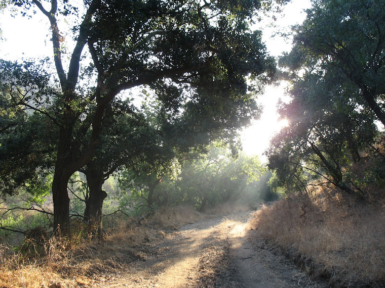
A half-century before the St. Joseph's Hill of Hope religious organization established its campus in Carbon Canyon, adjacent to Sleepy Hollow, the canyon welcomed what was almost certainly its first alternative religious figure:  James McGregor Beatty, known locally as the "Sage of Sleepy Hollow."

Beatty was one of the community's first residents, moving to what he called "Oak Lodge" in 1924, within a year of the creation of the neighborhood by Cleve Purington and his associates.  He was known to locals as a former vaudeville performer, songwriter, and author, though his accomplishments may have been slightly inflated by Beatty himself.

He was born near Pittsburgh, Pennsylvania in November 1881 as the only surviving child of Pennsylvania native Sherrard Beatty, who appears to have died young of the effects of yellow fever contracted while working on barges in the Gulf of Mexico, and British-born Elizabeth McGregor.

Sometime after 1900, Beatty and his mother migrated west and settled in Los Angeles, where the young man took up employment as a "card writer" or a "show-card writer," an occupation he had for about fifteen years.  An off-shoot of commercial writing, the show-card writer utilized concise writing and artistic technique in decorating cards that were placed in department store window displays.  Beatty worked for a time at the 5th Street department store in downtown Los Angeles, though later he utilized his skills for the American Photo-Slide Company, which manufactured magic lantern or glass slides that were used in early versions of slide projectors.  In 1918, he married Clara Victoria Henry in Los Angeles, but the marriage seems to have been short-lived.  Although he is listed as married in the 1920 census, the only other resident of his household was his mother.  The next census merely listed Beatty as single.

On the side, though, Beatty had bigger aspirations of two types.  The first was entertainment.  After all, Los Angeles and its environs, from about 1910 onward, became the motion picture capital of the world, but there were also live forms of entertainment that were highly popular, including vaudeville.

Beatty and his partner Joe F. Haberstock performed as "The Happy Hikers" and were described as "walking songwriters," whatever that meant.  In 1914, Beatty copyrighted two songs he composed for the act, including "Gee, But I Like to Hike" and "I Want a Ride on the Ocean of Love," both of which seemed to have looked to capitalize on two current crazes:  hiking and cruise ships.

In 1919, Beatty and Haberstock took their "Happy Hikers" act on the road, but not in the usual sense.  They decided to walk the 500-mile trip from Los Angeles to San Francisco, performing their routine along the way.  There isn't any known record of how successful their tour was, but a bee-keeping journal did publish a photo they took of a bee swarm outside of a San Jose theater, at which the duo was performing.  Funny what you can find in the way of obscurities on the Internet!

The other ambition, however, was philosophical.  By the late 1910s, Beatty, who was raised in the Methodist Episcopal Church, met an English-born spiritualist and psychic named George Francis, who had come to Los Angeles and worked as a department store detective, perhaps at one of the retail outlets where Beatty did his card writing.

A portrait of James McGregor Beatty, the "Sage of Sleepy Hollow," from his obituary in the Chino Champion, 4 August 1939.
Francis reinvented himself as the "Rev. George Francis" of the "Spiritualist Church of Truth" or "Francis Church of Truth," which had a space on the eighth flood of the Hamburger Building (Hamburger's was a major department store in those days and it may be that the two men were working there at some point) at 8th Street and Broadway.

Los Angeles was filled with all manner of alternative religions, spiritual organizations, cults and what have you during these early years of the 20th century.  This was so well-known so that, given the region's fame as an agricultural empire featuring oranges, lemons and walnuts, among other crops, the area became known as the "land of fruit and nuts," the latter referring, of course, to the wide range of religious entities that existed at the time.

For example, there were such organizations as the "Spiritualist Church of Revelation;" "Church of Ancient Mystery;" "Universal Brotherhood and Theosophical Society;" "Rosicrucian Church;" "Home of Truth;" "Universal New Thought Studio;" and the "Kingdom of Light New-Era Church," among many others.  It was also the era of some very popular preachers (and, in many cases, con artists), including Aimee Semple McPherson, "Fighting" Bob Shuler, and many more.

A devotee of the church, Beatty penned two books that attempted to provide legitimacy for spiritualism.  In 1919, he self-published Illustrious Madmen of the Ages about well-known persons who possessed spiritual and psychic powers.  Two years later, the Torch Press of New York issued the highly-alliterative Pesky Problems for Positive Preachers, which can actually be purchased in new digital editions.

This work sought to prove that "there is no death," in that the spirits of people live on and can be commnunicated with.  Beatty published letters sent and, in a few cases, even answered to and by pastors of mainstream churches concerning the legitimacy of spiritualism.   He peppered the text with references to ancient pagan religions, Buddhism, Christian scripture and the work of spiritualists and other alternate points of view.

The last chapter, Beatty claimed, was a late addition to the already completed work when he was at a "circle," a Tuesday night gathering conducted by George Francis, and "a message came through automatic writing . . . during two sittings, and is printed exactly as it was given, from spirit realms, word for word."

Notably, in his brief dedication, he claimed his father was a "positive preacher" and thanked his mother for being "my helper and co-worker in the cause of Truth."  Beatty also wrote that, years before, he had been in a "Psychical Research Society," though whether this was in Los Angeles or his native Pennsylvania was not stated.

Finally, Beatty penned a few poems touching upon his devotion to spiritualism, including this briefer example"

Give us Love and give us Laughter,
and a hand-clasp firm and true.
Give us Help and lend us Courage,
For the task 'tis ours to do.
Give us Facts instead of Fancy,
Show us Truth instead of Creed,
Give us Love and Light and Kindness;
SERVICE, is the world's great need.

In 1923, he published a long-form poem called 'Tis Dawn which he stated was also through "directed writing" and which was presented to famed magician Harry Houdini, an avowed anti-spiritualist.  A decade later, he copyrighted a musical version of the poem.  In 1928, while he was living in Sleepy Hollow, Beatty issued, through a printer in nearby Placentia his Stepping Stones, and Other Thoughts in Verse and Prose.

Beatty and his mother, who had been renting rooms in downtown Los Angeles since they arrived in the area, purchased their Sleepy Hollow property and built their home by 1924, because, it was said, "invalidism" caused by rheumatism in his legs led to his retirement "from the stage," or, at least, from card writing.

Beatty's way with words led him to be appointed secretary of the Sleepy Hollow Water and Improvement Company, which developed the subdivision, and then San Bernardino County Waterworks  District, No. 8, embracing Sleepy Hollow.

The Chino Champion of 21 August 1931 published this article about plans to broadcast songs of James M. Beatty on Los Angeles' KFWB radio station.
In 1931, the Chino Champion reported that Los Angeles radio station KFWB, then run by the Warner Brothers film studio, was planning to broadcast songs written by Beatty, some of which evidently were unpublished along with others that were.  Interestingly, the article stated that Beatty not only came from a family of musicians and "at an early age improvised music on an organ," but that he "toured the world" as part of his vaudeville career.

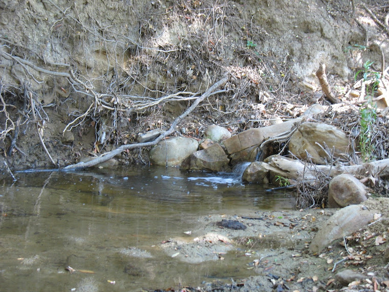
Also of note was that his residence "Oak Lodge" was described as being "beside the main highway through the canyon just a short distance north of Tidwell Oaks store."  The Tidwell store and home were where Carbon Canyon Road intersects with Rosemary Lane in Sleepy Hollow, south of Carbon Canyon Road.  It may be that Beatty's home was across the highway a bit to the east.

In late July 1939, at the age of fifty-seven, Beatty died from complications of bronchial pneumonia at the San Bernardino County Hospital and was buried in Fullerton.

03 December 2015

Carbon Canyon Historic Artifact #48: Groovy La Vida Dressing Room, 1960s

Here is another Amescolor postcard of La Vida Mineral Springs during the Swinging Sixties, showing the dressing room used before and after guests took to the hot mineral baths.


For its time, the resort was definitely modern and up-to-date.  Note the acoustic ceiling tiles, flourescent lighting fixtures, formica counters, plastic chairs and so on.  While some might cringe at the decor, there are plenty of fans that love this era and its space-age styles.

Walking through part of this site now, it is really hard to imagine the facility being there with its motel, cafe, bath house, swimming pools, landscaping and other elements.


It is pretty difficult to picture a comeback, despite statements that the Japanese owner of the property has contemplated investing $35 million in a new mineral springs resort.